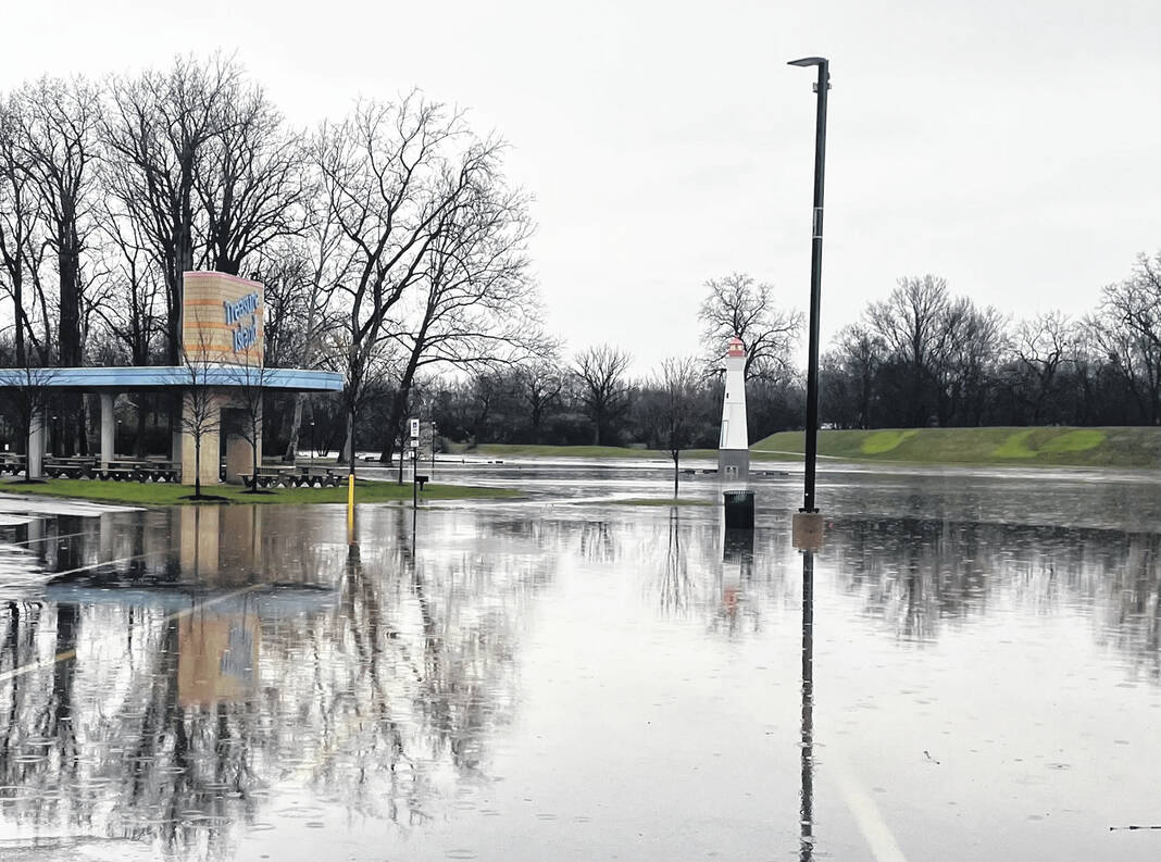
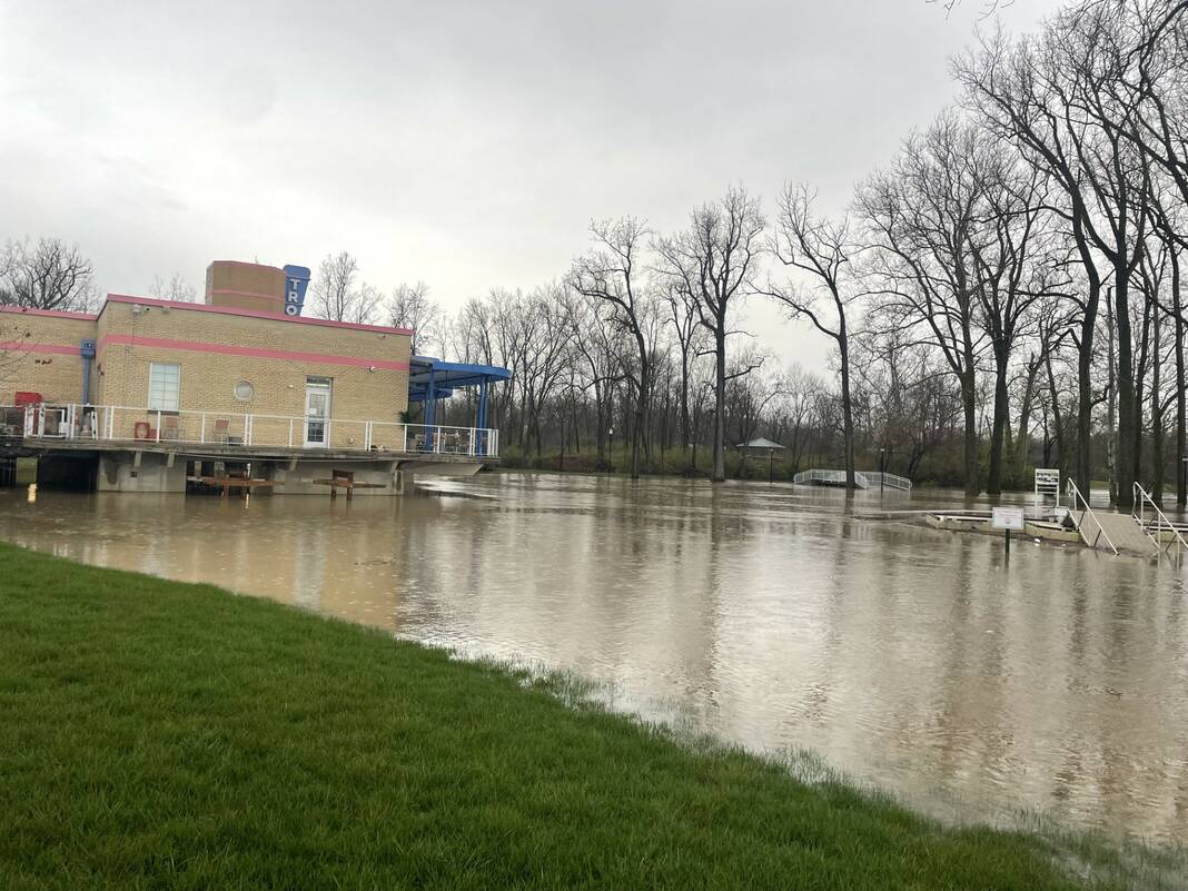
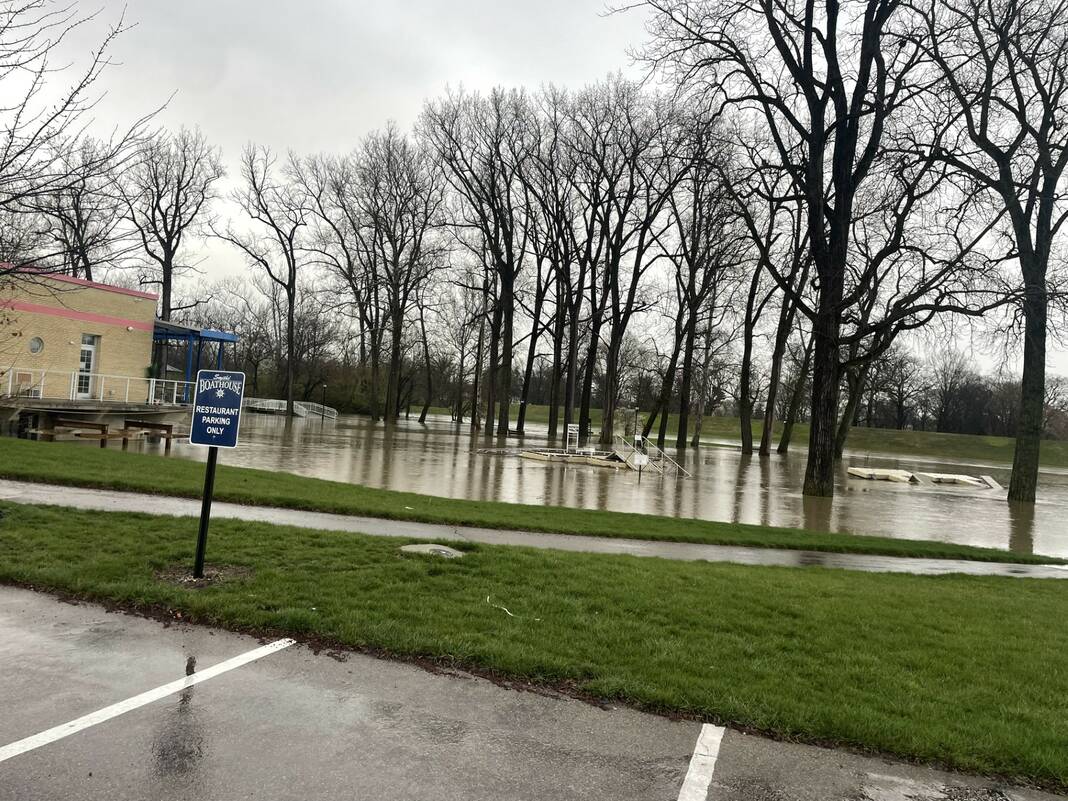
After days of rain and continued rainfall on Tuesday, the Great Miami River has swelled onto the sidewalks, parking lot and grass areas at Treasure Island Park in Troy.
Sheryl Roadcap | Miami Valley Today
Sheryl Roadcap | Miami Valley Today
Sheryl Roadcap | Miami Valley Today
By Sheryl Roadcap
TROY — The National Weather Service (NWS) in Wilmington is warning of the possibility of severe weather, including tornadoes and flooding in Miami County on Tuesday, April 2, said the Miami County Emergency Management Agency (EMA).
Joel A. Smith, director of Miami County EMA, warned residents need to stay weather-aware through TV or weather apps, and take appropriate action if alerts are issued.
A flood watch was been issued by the NWS until 8 p.m. on Tuesday. Excessive runoff may result in flooding of rivers, creeks, streams and other low-lying and flood-prone locations. NWS’s website said multiple rounds of showers and storms are expected through Tuesday evening. Each round of storms will have the potential to produce heavy rain. Total rainfall amounts of 2-to-4-inches, with locally higher amounts possible.
Precautionary/preparedness actions for people in the watch area, that are recommended by the NWS, for especially those living in areas prone to flooding should be prepared to take action should flooding develop. Monitor the latest forecasts and be alert for possible flood warnings.
According to the NWS, on Tuesday showers likely with the possibility of thunderstorms throughout the day. Some storms could be severe, with heavy rain. Temperatures high near 69 with southeast wind from 11 to 17 mph, becoming southwest in the afternoon. Chance of precipitation is 80%. New rainfall amounts between a 10th and quarter of an inch, except higher amounts possible in thunderstorms.
Tuesday night, showers and thunderstorms are expected before 11 p.m, with a chance of showers between 11 p.m. and 1 a.m. Some storms could be severe, with heavy rain. The temperature a low around 39. West wind around 17 mph, with gusts as high as 30 mph. Chance of precipitation is 80%. New precipitation amounts of less than a 10th of an inch, except higher amounts possible in thunderstorms.
On Wednesday, showers are likely, with thunderstorms also possible after 5 p.m. It is expected to be mostly cloudy, with a high near 46 degrees and southwest wind from 14 to 17 mph. Chance of precipitation is 70%. New rainfall amounts of less than a 10th of an inch, except higher amounts possible in thunderstorms. Rain and snow showers are expected Wednesday night. Some thunder is also possible with a low around 34 degrees and a west wind from 10 to 13 mph. The chance of precipitation is 80%, with little or no snow accumulation expected.
For timely details on official weather briefings, visit: https://forecast.weather.gov/MapClick.php?lat=39.6096505&lon=-84.0129676
